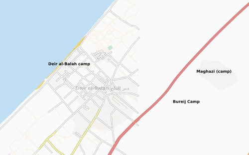
 I just heard from Mikel Maron that the OpenStreetMap team is working hard to update routes within Gaza in an effort to provide better data sets for humanitarian groups. I love this type of on-the-fly work and I have a lot of respect for the OSM team and their willingness to drop what they are doing and start working on a critical map feature. The flexibility OSM has shows it’s value as a quickly adaptable humanitarian tool. I believe Deir al-Balah camp was just added a short while ago:
 OSM is looking at ways to quickly purchase satellite imagery to support their emergency mapping efforts. If you are interested in helping raise funds for their efforts or IF YOU HAVE KNOWLEDGE OF GAZA STREET NAMES AND FEATURES add your name to their Wiki or drop me a line at aidworkerdaily@gmail.com. I should have more information shortly on how they’re planning on handling offers of assistance. In the mean time, you can follow developments over at their OpenStreetMap Gaza Wiki.
UPDATE: Reuters AlertNet has a write-up on the OpenStreetMap Gaza intiative which you can link to here.
